Places
Hiking in Sedona: The Best Trails by Difficulty, with Parking and Heat Advice
Hiking is the best way to see Sedona. The red buttes that fill the postcards are ringed by trails of the Coconino National Forest, many starting a few minutes’ drive from town, and the most famous are short: the Forest Service lists Cathedral Rock at 1.1 miles roundtrip, Devil’s Bridge at 1.6 miles roundtrip from its own trailhead, and Doe Mountain at 0.7 miles to the top of its mesa. Short does not mean easy. Several climb steep bare rock, most have little or no shade, and parking at the famous trailheads fills early.
This guide covers the trails people search for most, with the Forest Service’s own figures for distance, climb and time, plus where to park, when to go and what to carry. Figures can change after storms, fires and trail work, so check the trail’s Forest Service page or the Red Rock Ranger Visitor Center before you set out.
Sedona trails at a glance
All figures are from the Coconino National Forest trail pages. “RT” means roundtrip.
| Trail | Distance | Climb | Forest Service rating |
|---|---|---|---|
| Cathedral Rock | 1.1 mi RT | 669 ft | Strenuous |
| Devil’s Bridge (own trailhead) | 1.6 mi RT | 371 ft | Moderate |
| Soldier Pass | 4 mi RT | 641 ft | Moderate |
| Boynton Canyon | 6 mi out and back | 931 ft | Moderately challenging |
| Airport Loop | 3.5 mi loop | 535 ft | Moderately challenging |
| Doe Mountain | 0.7 mi to the top | 542 ft | Moderately challenging |
| Brins Mesa | 3.5 mi one way | 649 ft | Easy to moderate |
| Bell Rock Pathway | 3.5 mi one way | 185 ft | Easy, family-friendly |
| West Fork of Oak Creek | first 3 mi maintained | small | Easy |
Two of these pages disagree with themselves, which is worth knowing. The Cathedral Rock page lists 1.1 miles roundtrip in its summary but describes a 1.5-mile hike in its trail notes; the Soldier Pass page lists 4 miles roundtrip but its description gives 4.5 miles. The Bell Rock Pathway is 3.5 miles one way on the Forest Service page and 3.6 miles on its Recreation.gov listing. Plan for the longer figure.
Before you go: passes, shuttle and the visitor center
Most of the trailheads in this guide are fee sites. The Forest Service pages say a Red Rock Pass or America the Beautiful Pass is required to park at the Cathedral Rock, Boynton Canyon, Doe Mountain and Bell Rock Pathway trailheads, among others. Stopping for a few minutes to take a photograph at a scenic vista does not need a pass, according to Visit Sedona. Our guide to the Red Rock Pass and parking explains the passes, what each costs and how the shuttle works.
For the busiest trailheads, the Forest Service suggests the free Sedona Shuttle, which serves specific trailheads Thursday through Sunday. It is the easiest way to reach Cathedral Rock and Soldier Pass, where parking is tiny.
The Red Rock Ranger Visitor Center, at 8375 State Route 179, is the place for current trail conditions and maps. It is open 9 a.m.-4:30 p.m. on most days and 12 p.m.-4:30 p.m. on Wednesdays, and it gives out a free Forest Recreation Guide with a map.
Cathedral Rock: short, steep and spectacular
Sedona’s most photographed butte has its most demanding short trail. The Forest Service calls it “more of a rock climb than a hike”: unshaded, steep and difficult in places, rated strenuous, with 669 feet of climbing from a trailhead at 4,043 feet. Allow about 1.5 hours.
The route follows cairns across a wash and up toward the spires. At 0.25 mile it reaches a broad ledge with views, then climbs steeply over bare rock and up a shallow cleft with toeholds notched into the stone. The main trail ends on a wide saddle between two spires, with Sedona spread out below. An unmaintained path leads on along the base of the spires to two more saddles and a close-up view of an exposed lava dike, the black basalt that cuts through the red sandstone.
Practical points:
- Footwear with grip matters more here than anywhere else in Sedona.
- Coming down is harder than going up. Take it slowly on the polished rock.
- Avoid wet or icy rock, and avoid the midday heat in summer; the page warns it is hot.
- Parking is a small lot off Back O’ Beyond Road; the shuttle is the easier option on its operating days.
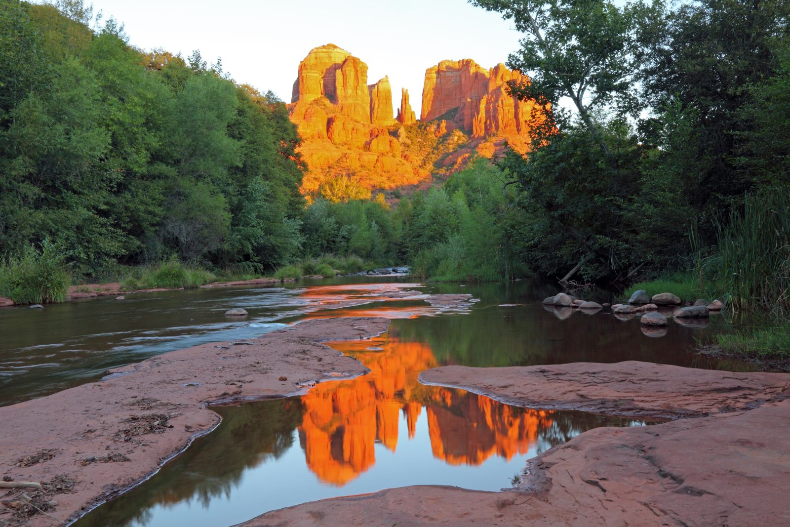
For the classic view of Cathedral Rock without the climb, go to Red Rock Crossing at the Crescent Moon picnic site, where the butte reflects in Oak Creek.
Devil’s Bridge: the biggest arch
Devil’s Bridge is the largest natural sandstone arch in the Sedona area, and one of the most popular hikes in town. From its own trailhead, at 4,605 feet, the Forest Service lists a moderate 1.6-mile roundtrip with 371 feet of climbing, about 2 hours roundtrip. The trail starts as an old jeep track through juniper and prickly pear, climbs gently, then splits: left to the base of the 50-foot-high arch, right up a steep natural rock staircase to the top. You can walk across the arch itself. It is wider than it looks from below, but it is a long way down, so take care.
The catch is the road. The last stretch of Dry Creek Road (FR 152) to the trailhead is rough, needs a high-clearance vehicle and is not recommended in wet weather. It is also a popular jeep trail and not recommended for walking. Most hikers park lower down and walk in on trails instead:
- From the Dry Creek Vista Trailhead via the Chuckwagon Trail: about 2.9 miles each way, 5.8 miles round trip.
- From the Mescal Trailhead via the Mescal and Chuckwagon trails: 4.0 miles round trip.
At popular times expect a queue of people waiting for a photo on the arch. Early morning is quieter and cooler.
Soldier Pass: a sinkhole, pools and an arch
Soldier Pass packs more variety into a few miles than any trail in Sedona. The Forest Service rates it moderate, with 641 feet of climbing from a trailhead at 4,444 feet, about 2.5 hours roundtrip.
A quarter mile in, the trail passes Devil’s Kitchen, a sinkhole just off the path. It is one of at least seven sinkholes around Sedona, about 660 feet deep with a cave that adds 180 feet, and a second collapse happened as recently as late 1989; stay back from the edge. A quarter mile further are the Seven Sacred Pools, small natural basins in the sandstone fed by a seasonal stream, so they may be dry. Local jeep guides gave them their name.
Beyond the pools the trail climbs through Arizona cypress to the wilderness boundary, where a steep side branch leads to an arch. The main trail then climbs, increasingly steep and rocky, to the pass and onto Brins Mesa, with views south over Sedona and north to the cliffs of the Mogollon Rim.
Know before you go:
- The trailhead is open only from 8 a.m. to 6 p.m., and has only 14 parking spots and no restrooms or trash cans.
- The first half is often busy, with jeep tours and off-road vehicles nearby; motorized access beyond the trailhead needs a permit.
- Bicycles are allowed only for the first 1.3 miles, to the wilderness boundary.
- The shuttle is the easiest way to get there on its operating days.
Boynton Canyon: the vortex canyon
Boynton Canyon is one of the most scenic box canyons in Red Rock Country, reached on paved roads with a trailhead just outside the entrance to the Enchantment Resort. The Forest Service lists 6 miles out and back, 931 feet of climbing from 4,525 feet, and about 2.5 hours each way, rated moderately challenging.
The trail skirts the resort before dropping back to the canyon floor, where the walking is pleasant and easy among towering buttes, crimson cliffs and natural desert gardens. Watch for wildlife, from songbirds to shy whitetail deer. The Forest Service notes that Boynton Canyon has become even more popular since it developed a reputation as a site of a spiritual energy vortex, adding “whether or not you follow this belief”. Visit Sedona lists it among the four best known vortex sites. Expect company: the Forest Service itself warns you may have more than you hoped for.
Airport Loop: views all the way round
The Airport Loop circles the upper slopes of Airport Mesa, also called Table Top Mountain, right in town. The Forest Service lists 3.5 miles, 535 feet of climbing and 2-3 hours for the loop, from a trailhead at 4,580 feet, rated moderately challenging with some rocky spots.
The views are constant: red rock from northeast to south over the lower Oak Creek valley, then West Sedona, Capitol Butte and Wilson Mountain. A half-mile spur, the Table Top Trail, leads out to a point with panoramic views. There is no shade until the last mile, so this is a cool-season or early-morning hike. Airport Mesa is also one of the four best known vortex sites.
Bell Rock Pathway and Courthouse Butte
For an easy walk among the big landmarks, the Bell Rock Pathway is the answer. The Forest Service rates it easy and family-friendly: 3.5 miles one way with only 185 feet of elevation change from a trailhead at 4,192 feet, about 2.5 hours roundtrip. It parallels State Route 179, with views of Bell Rock, Courthouse Butte and other landmarks, and restrooms at the northern and southern trailheads. Most of the surface is wide and hard, though there are some steep hills and rough patches around Bell Rock. Horses and mountain bikes share it.
From the pathway, short scrambles lead onto Bell Rock itself. The most popular route is a moderate climb to a small plateau on the northwest face; the summit, at 4,919 feet, takes a challenging unmarked route and is best left to experienced scramblers. Courthouse Butte, just to the east, rises to 5,454 feet.
Brins Mesa and Doe Mountain: big views, modest effort
Brins Mesa starts at the edge of town and climbs into open country with unobstructed views of Coffee Pot Rock, Wilson Mountain and Chimney Rock. The Forest Service lists 3.5 miles one way with 649 feet of climbing from 4,632 feet, about 1 hour 45 minutes each way, rated easy to moderate. It can be a bit hot in summer. It connects with Soldier Pass for a longer outing.
Doe Mountain is the best short summit for the effort. The trail switchbacks up the north side of a low, flat-topped mesa: 0.7 miles to the top and 1.3 miles around the edge, with 542 feet of climbing from 4,615 feet, about 1 hour 30 minutes in all. From the 400-foot-high top you can pick out Bear, Maroon and Wilson mountains and the mouths of Boynton and Secret canyons.
West Fork of Oak Creek: Sedona’s canyon walk
North of town, in Oak Creek Canyon, West Fork is one of the most popular trails on the whole Coconino National Forest, and the coolest on a hot day. It follows a stream under towering cliffs, crossing it on stepping stones; the first 3 miles are easy, maintained and take 2-3 hours round trip. The trailhead sits at 5,325 feet, about 9.5 miles north of Sedona, and the forest describes it as fantastic all year, from spring songbirds to red and gold autumn leaves and winter icicles. Beyond the maintained trail the route continues as a rugged 14-mile wilderness trek that involves wading, boulder hopping and some swimming.
Three things to know:
- Closure: a Forest Service order closes the West Fork area from September 26, 2026 through October 31, 2026, because of rockfall and flood-debris hazards after rain in the watershed burned by the Pocket Fire. Check the forest’s alerts before planning a visit.
- Fees: the trailhead and the Call of the Canyon day-use site are run by a concessionaire. The listed fees are $15 daily (up to 5 people), $20 weekly, $50 annual and $4 walk-in.
- Rules: it is designated wilderness, so no bikes; dogs must be leashed and their waste carried out. The trail may also close in high fire danger, usually in late June.
Easy walks in the state parks
Two state parks offer gentler hiking with facilities on hand.
Red Rock State Park has a family-oriented 5-mile network of interconnecting loops through manzanita and juniper to the banks of Oak Creek. A volunteer naturalist leads a guided nature walk daily at 10 a.m., and there is a monthly guided geology hike (reservations required). Entry is $10.00 per adult; there is no swimming.
Slide Rock State Park, in Oak Creek Canyon, has several short trails on the grounds and along the creek: a stroll to pair with a swim.
Quieter trails in the wilderness areas
If the famous trailheads are full, the wilderness areas have trails with far fewer people.
- Munds Mountain Wilderness (18,150 acres) wraps around Bell Rock and Courthouse Butte. The Forest Service suggests the Jacks Canyon and Hot Loop trails, both climbing from canyon bottom to high overlook, and notes you may have them to yourself.
- Red Rock-Secret Mountain Wilderness (43,950 acres by the Forest Service’s count) holds arches, slot canyons and canyons up to 1,500 feet deep, with elk, mule deer, javelina and even black bear. The Vultee Arch trail follows Sterling Canyon to a plaque for Gerard and Sylvia Vultee, killed in an air crash on January 29, 1938; the sandstone arch across the canyon carries his name.
Wilderness trails are less marked and often longer. Bring a map and tell someone your plan.
When to hike
Sedona’s climate decides the best hours more than the trail does. By the long-term record, average highs run from 56.0°F in January to 96.1°F in July.
- Spring and fall: comfortable all day on most trails.
- Winter: pleasant walking in the middle of the day; frost and ice on shaded rock in the morning.
- Summer: start at first light. Visit Sedona advises hiking early and late, and choosing creekside and shaded trails if you go out during the day.
- Monsoon season: from July, afternoon thunderstorms bring lightning and flash floods; be off exposed rock and out of canyons before they build.
Our guide to Sedona weather by month has the full numbers.
Safety and trail manners
Heat, slick rock and wrong turns cause most trouble on Sedona trails. The basics from Visit Sedona and the Forest Service:
- Carry plenty of water. Visit Sedona gives a rule of thumb of a liter per hour, more in weather above 85 F.
- Protect yourself from the sun: broad-brimmed hat, sunglasses, sunscreen, light long sleeves.
- Wear shoes with a slip-free sole, and avoid steep rock when it is wet or icy; trails can be slippery and sometimes dangerous after rain or snow.
- Tell someone where you are going and when you will be back; carry a map, a charged phone and a first-aid kit.
- Watch where you put your hands and feet: rattlesnakes live in brush and rocky areas.
- Stay on the trail. The desert’s cryptobiotic crust is very delicate, and shortcuts scar it for years.
- Pack out all trash, and bury human waste at least six inches deep and 100 feet from any water.
Hiking, or a jeep and a guide?
Some of the best places around Sedona are on rough roads that need a high-clearance vehicle, such as the upper part of Dry Creek Road. If you want the scenery without the climb or the driving, an open-air jeep tour covers rough backcountry roads with a guide, and vortex tours combine short walks at Boynton Canyon, Airport Mesa or Bell Rock with a guide’s explanation of the beliefs around them. Compare the options in our Sedona tours comparison, and see our article on whether Sedona is worth visiting for how hiking fits a short trip.
Frequently asked questions
What is the most popular hike in Sedona?
Devil’s Bridge and Cathedral Rock are among the most popular, and both get crowded. Devil’s Bridge is the area’s largest natural sandstone arch; Cathedral Rock is a short, steep scramble rated strenuous by the Forest Service. Go early for both.
What is the easiest hike in Sedona?
The Bell Rock Pathway: 3.5 miles one way with 185 feet of elevation change, rated easy and family-friendly. The first 3 miles of West Fork are also easy, when the trail is open.
Do you need a pass to hike in Sedona?
At many trailheads, yes: the Forest Service requires a Red Rock Pass or America the Beautiful Pass to park at sites such as Cathedral Rock, Boynton Canyon and Bell Rock. West Fork has its own concession fee. The free shuttle avoids parking altogether at the trailheads it serves.
How long is the Devil’s Bridge hike?
1.6 miles roundtrip from its own trailhead, which needs a high-clearance vehicle. Most hikers start lower: 4.0 miles round trip from the Mescal Trailhead, or 5.8 miles from Dry Creek Vista.
When is the best time of day to hike in Sedona?
Early morning, in every season but winter. It is cooler, the light is better, parking is easier, and in summer you avoid the afternoon storms.